 | 
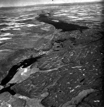
Figure 5.11 (Large view) Grand Coulee in Washington State

The severely eroded landscape is viewed toward the northeast, in this high-altitude, oblique, aerial photo. Water from the ice-blocked channel of the Columbia River was diverted southwestward, as a flood through the Upper Grand Coulee. The Flood eroded the trench now occupied by Bank Lake (the two-mile-wide lake in top center of photo). The flood proceeded southwest, forming the severely scoured landscape of the Lower Grand Coulee (lower half of photo). The western edge of the flood-scoured zone is the 1000-foot-high cliff on the west side of Park Lake (lower left corner of photo). The boundary between the upper and lower Coulee is Dry falls—a broad vertical escarpment (center of photo) up to 350 feet high and five times the width of Niagara Falls. Water from this flood was estimated to have had a depth of over 200 feet, and velocity of over 60 feet per second. Imagine how puny Niagara Falls would appear next to Dry Falls in its prime! (Photo copyright by Leonard Delano.)
 |

